Markets we serve

Land Development

Whether greenfield development or expansion and improvement of existing land development sites, DAS provides the engineer design level maps you need.
Download brochure

Recently completed projects // View all projects

ALTA Survey Site

DAS Acquired 2.0cm imagery and produced high-resolution digital orthophotography and planimetric mapping for a 12.7 acre site, including Aerial Triangulation, Stereo Compilation of all visible surface improvements, and DTM of mass points and breaklines. Deliverables included 1"=20' Scale planimetric mapping in an AutoCAD DWG and 0.07-foot ground resolution digital orthophotography in ECW.

1,692 Acre Development Site

DAS Acquired 5cm imagery and 15ppsm LiDAR data at a development site, including Ground survey and aerial targeting, Aerial Triangulation, LiDAR data processing, Stereo Compilation of all visible surface improvements and breaklines, and DTM of LiDAR bare earth points and photogrammetric breaklines. Deliverables included 1"=40' Scale 2D and 3D planimetric mapping in AutoCAD DWG, 3D one (1)-foot contour data in AutoCAD DWG, 3D DTM data (includes 3D planimetric features) in AutoCAD DWG, 0.25-foot ground resolution digital orthophotography in enhanced compression wavelet (ECW), TIN Data in Land XML, and Ground control.

487 Acre Development Site

DAS Acquired 5cm imagery and 2 to 4 ppsm LiDAR data for a 487 acre development site, including Ground survey and aerial targeting, Aerial Triangulation, LiDAR data processing, Stereo Compilation of all visible surface improvements and breaklines, and DTM of LiDAR bare earth points and photogrammetric breaklines. Deliverables included 1"=50' 2D and 3D planimetric mapping in AutoCAD DWG, 3D one (1)-foot contour data in AutoCAD DWG, 3D DTM data (includes 3D planimetric features) in AutoCAD DWG, 0.25-foot ground resolution digital orthophotography in enhanced compression wavelet (ECW), and Ground control.

Our Land Development Solutions

Analysis & Analytics

DAS Geospatial provides expert data processing and analysis for many industries. Our geospatial solutions include engineer-design level maps, LiDAR classification and feature extraction, point cloud colorization, and a wide variety of industry-specific analytics, from transportation to mines and landfills.

Survey Services

DAS Geospatial provides expert aerial survey services for any industry. Our geospatial solutions include GPS ground control surveys, topographic surveys, terrestrial LiDAR, and bathymetric surveys.

Aerial Mapping

DAS Geospatial provides expert aerial mapping for any size project and industry. Our geospatial solutions include design-level maps, digital orthophotography, contour maps, planimetric maps, GIS feature collection, DEM/DTM, basemaps, corridor maps, 3D animated fly throughs, vegetation maps, and facility mapping.

Aerial LiDAR

DAS Geospatial provides expert aerial LiDAR for commercial, industrial, and transportation applications. Our geospatial solutions include end-to-end LiDAR data acquisition from mobile and terrestrial platforms complete with data processing and engineer design level point clouds.

Aerial Photography

DAS Geospatial provides expert aerial photography for any industry. Our aerial photography solutions include oblique imagery, near-infrared imagery, aerial video, thermal imagery, and construction progress imagery.

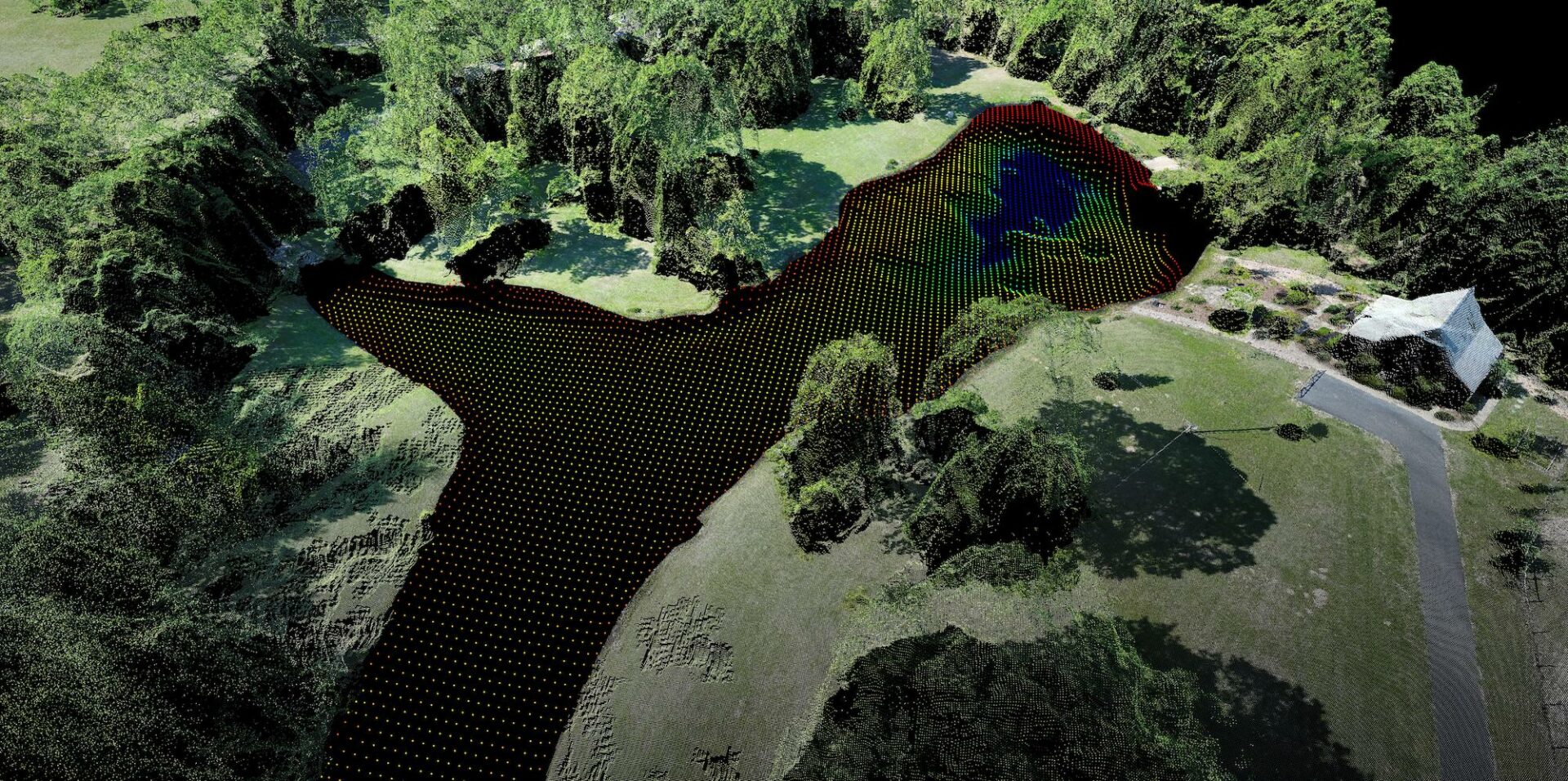
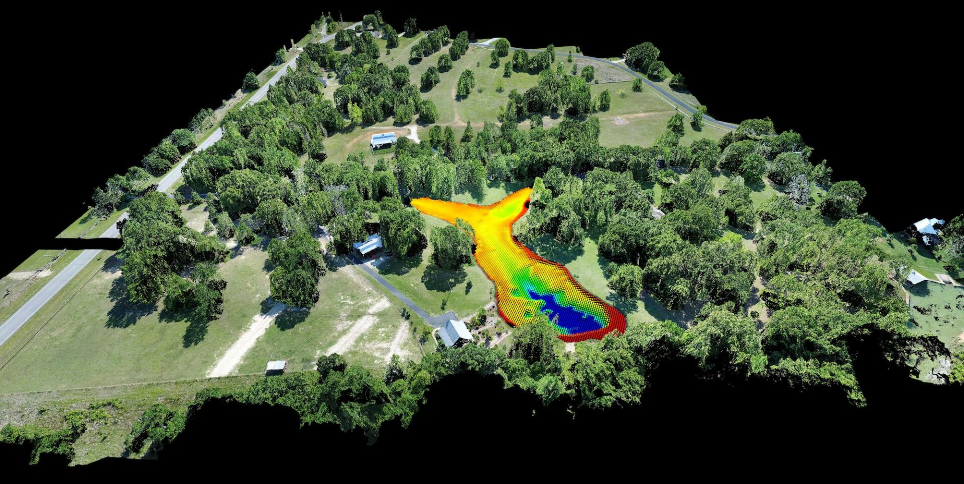
Land Development Use Cases

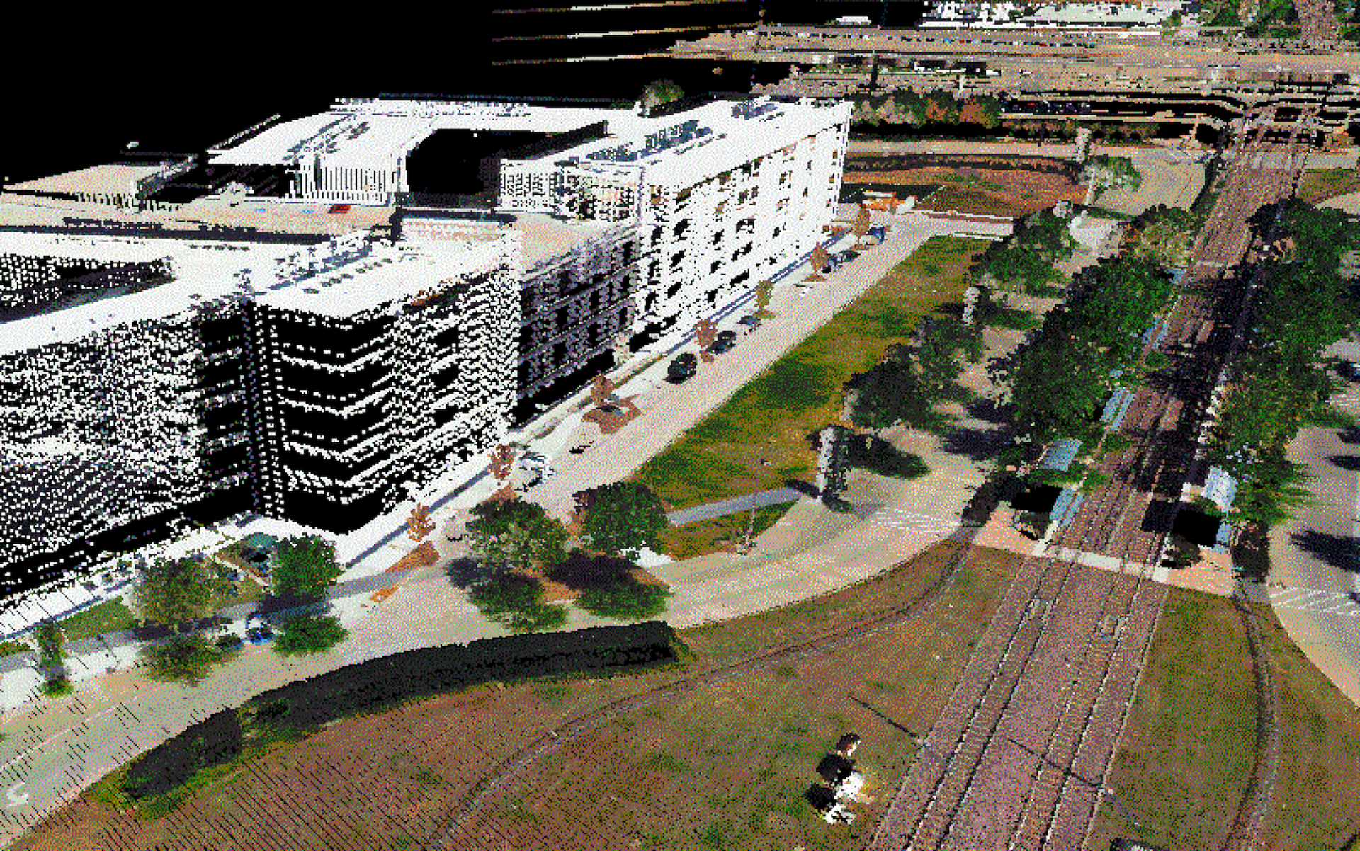
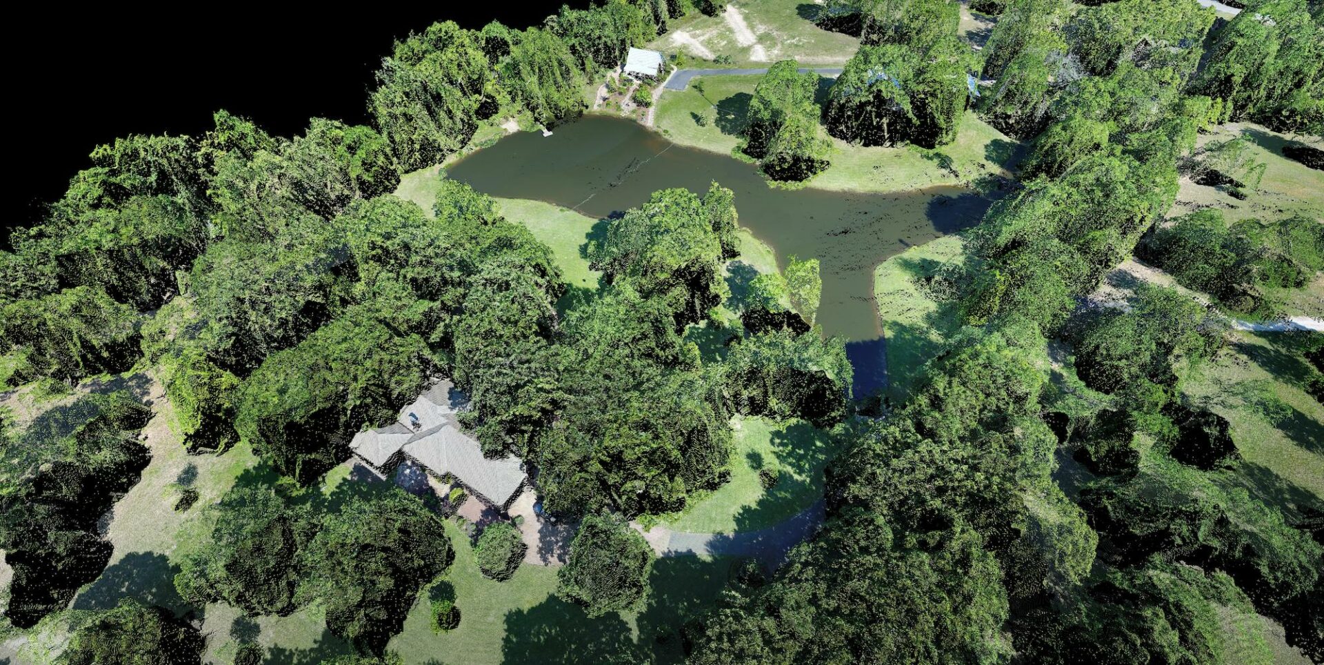
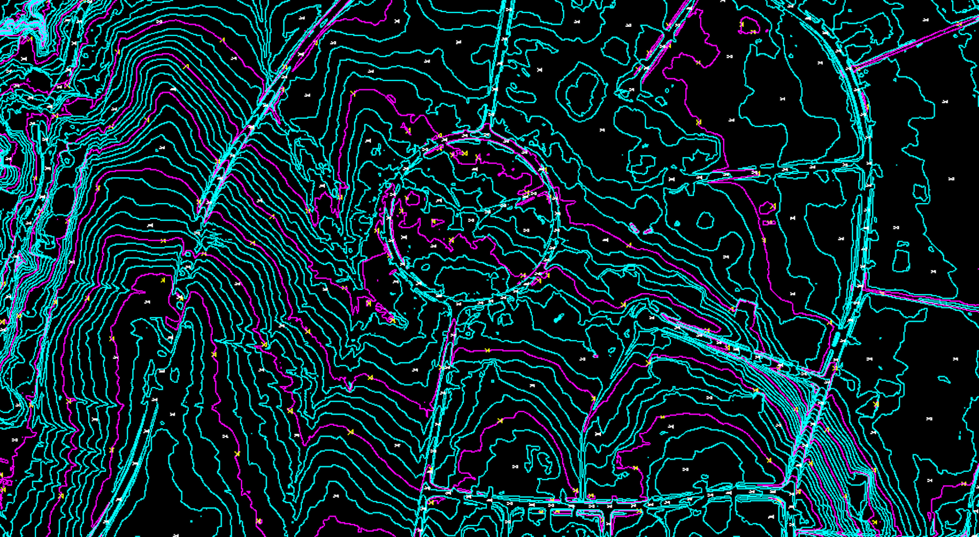
Leading land developers rely on our geospatial solutions to manage residential, commercial, industrial, and infrastructure projects, including site survey and topographic mapping, Alta surveys, drainage studies, and environmental mapping. Plus, Leverage our aerial mapping, LiDAR, feature extraction, terrain modeling, and up-to-date imagery for the best possible view of your properties.

A Legacy of Innovation

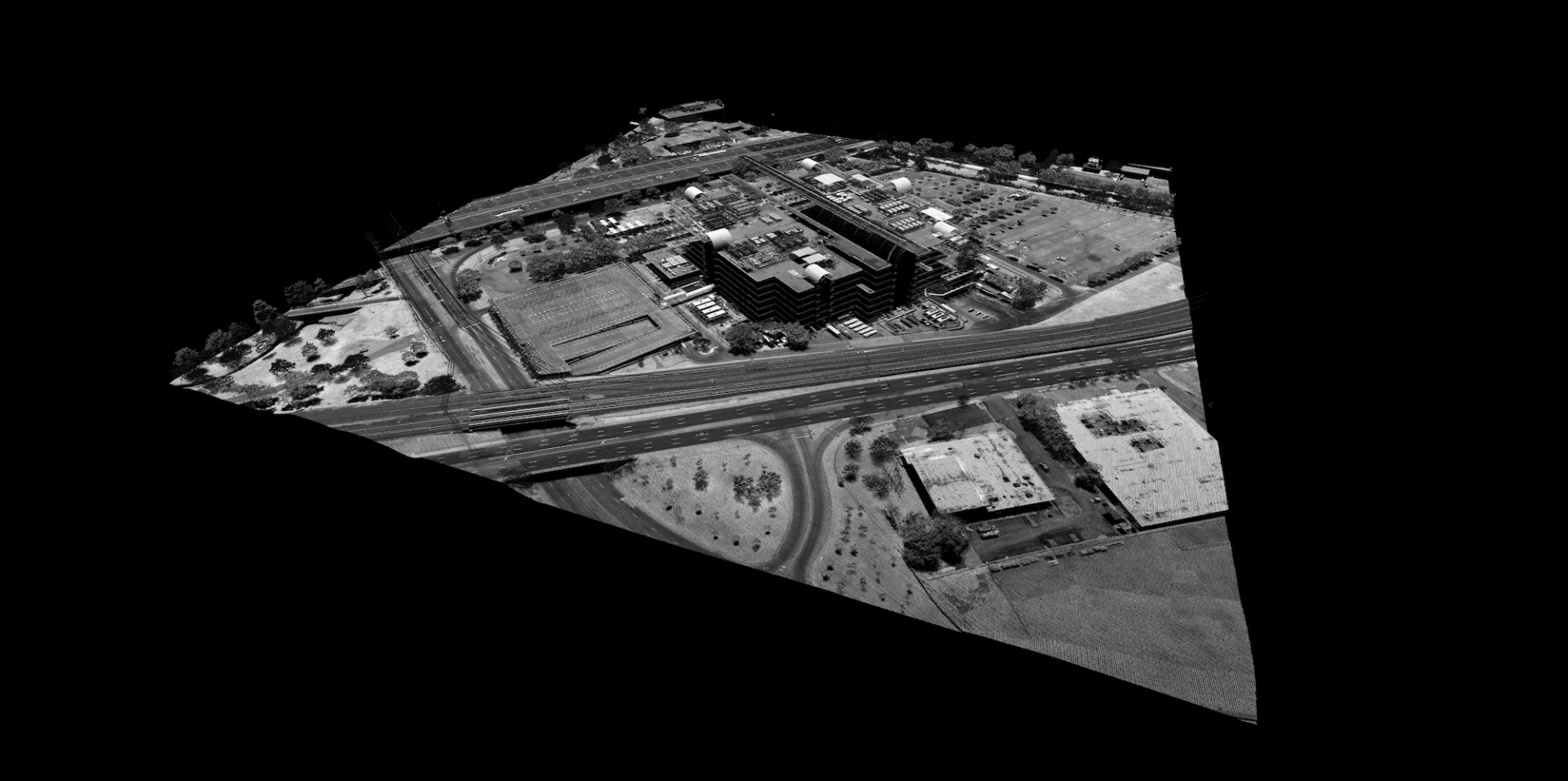
For more than 45 years, DAS has continuously incorporated the latest technologies to deliver best-in-class geospatial solutions for our land development clients, from fixed wing, helicopter, UAV, and ground-based platforms to data processing, analytics, and engineer design level mapping. DAS provides aerial imagery, LiDAR data collection, and digital orthophotography to empower you to drive construction engineering designs and decisions with high quality topographic maps, planimetric feature extraction and attribution, digital terrain models, remote sensing, and more.