Our solutions
Analysis & Analytics
DAS Geospatial provides expert data processing and analysis for many industries. Our geospatial solutions include engineer-design level maps, LiDAR classification and feature extraction, point cloud colorization, and a wide variety of industry-specific analytics, from transportation to mines and landfills.
“DAS Geospatial’s ability to acquire LiDAR data with a plane and process high quality point clouds of our construction projects enables us to do everything we need to in a single pass, saving days and money compared to traditional surveys.”
Project Engineer at a Dallas-Based Architectural Firm
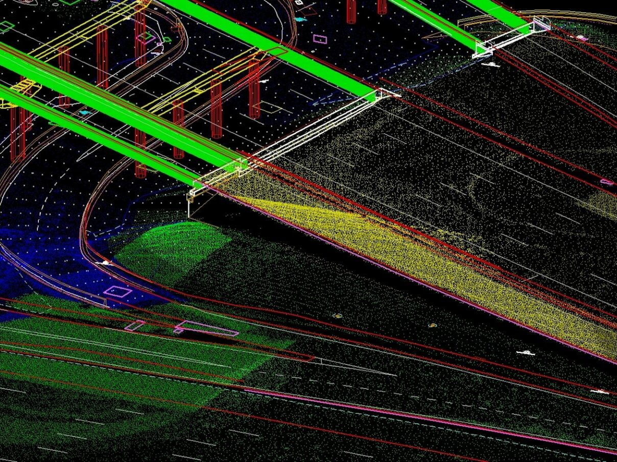
Delivering Engineer Design-Level Accuracy
To deliver design-level aerial surveys and maps requires a robust data processing workflow, specialized software, and skilled employees. Our geospatial experts have more than 450 years of combined photogrammetric experience, which is incorporated into our project data processing. This level of specialization provides DAS Geospatial’s clients with superior, cost-effective, and more reliable data on any aerial platform (fixed wing, helicopter, UAV).
Powering Your Workflow and Analysis
At DAS we understand that aerial data acquisition is only the first step in your engineering workflow or project analysis, underscoring the need for decision-ready datasets. We process and prepare the data to meet specific client or project requirements. DAS Geospatial can deliver digital assets that include DSMs, point clouds, high-resolution video and still imagery, orthophotography, and other specialty data types in industry-standard formats.
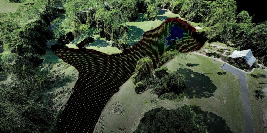
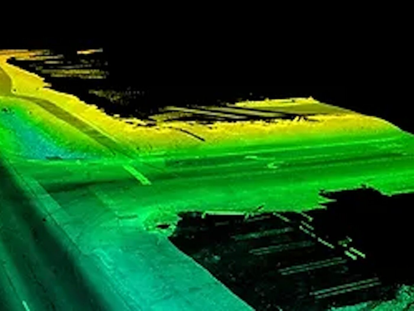
Point Cloud Data Processing
DAS Geospatial provides several value-added point cloud processing steps to provide your team with decision-ready datasets, including classification, the process of separating and labeling LiDAR-acquired data points based on the type of object. We also provide point cloud feature extraction to identify features or objects as well as advanced techniques to render pixel-perfect, fully colorized point clouds.
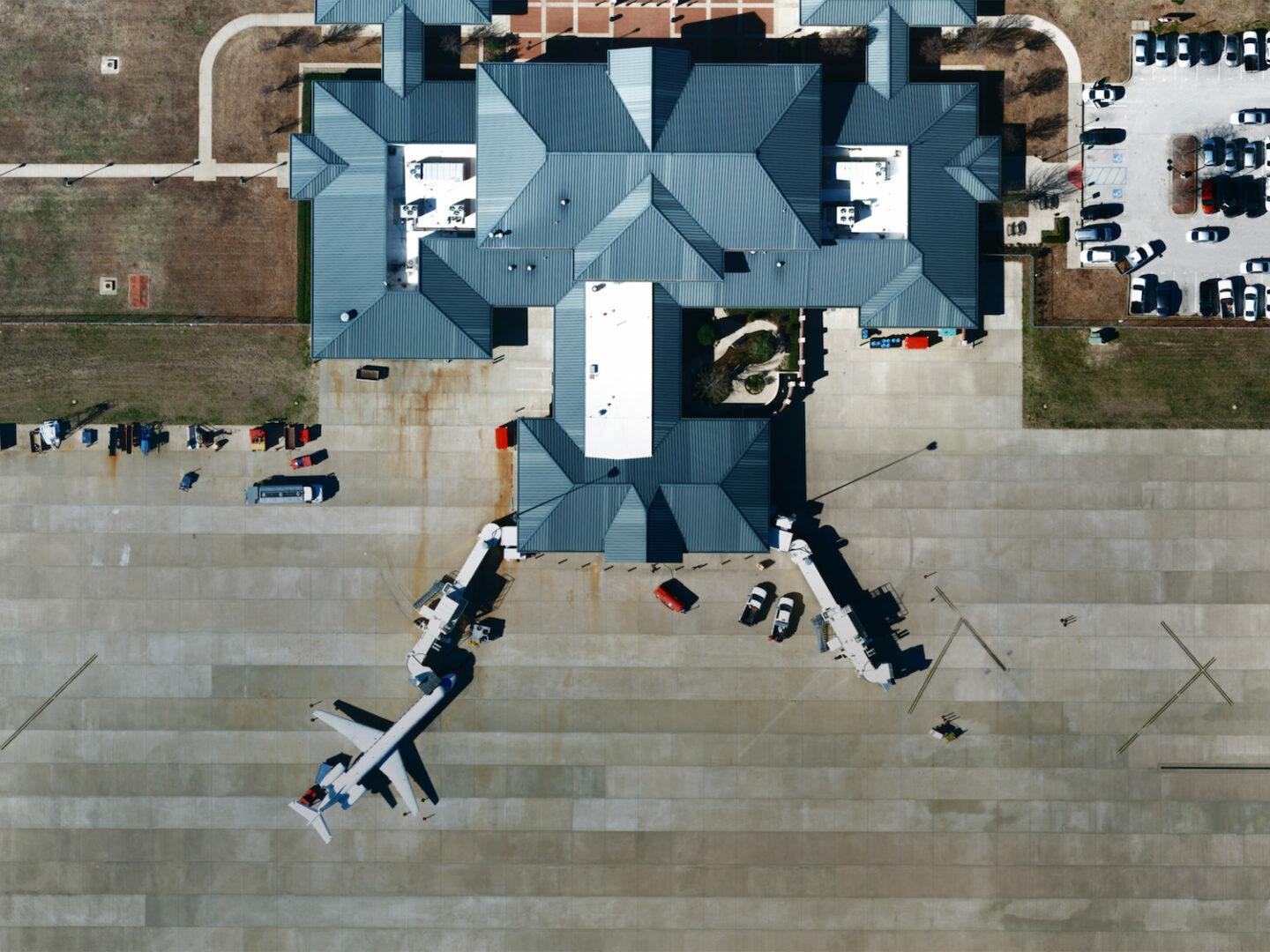
Industry-Specific Data Analysis
Our geospatial solutions can be tailored for any application, with extensive experience in transportation, aviation, oil & gas, renewables, water management, land development, mines and landfills, and utilities.
Examples of our industry-specific data analysis include:
- Airfield Obstruction analysis
- Change detection (construction progress, etc.)
- Volume calculation (mines, landfills, etc.)
- ROW encroachment/vegetation analysis
- Electric utility wire sag analysis
- Highway traffic analysis