Our solutions
Survey Services
DAS Geospatial provides expert aerial survey services for any industry. Our geospatial solutions include GPS ground control surveys, topographic surveys, terrestrial LiDAR, and bathymetric surveys.
“Whenever we have a project over 20 acres, we always team with DAS to provide our clients with the fastest, most reliable, and cost-effective surveys that keep projects running like clockwork.”
Senior Surveyor at a Large Survey Contractor
GPS Ground Control Surveys
DAS Geospatial leverages the latest aerial survey techniques to enhance the positioning and accuracy of mapping outputs, including Ground Control Points (GCP), marked ground points with a precisely referenced geographic location. These can be used across our aerial platforms. GCP-acquired datasets are expertly processed with deliverables that include 2D Orthomosaics, 3D DEM/DTM, and 3D point clouds.
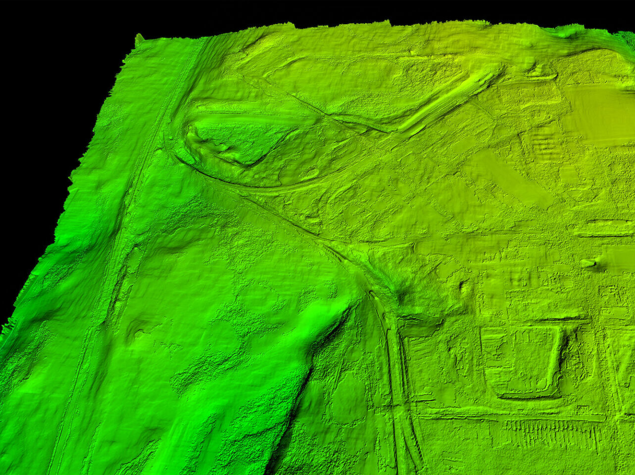
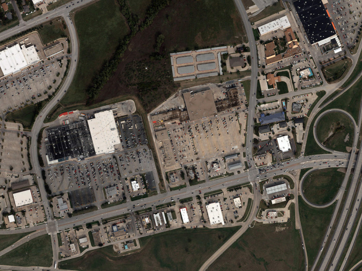
Topographic Surveys
Offering a complete suite of aerial data acquisition platforms to meet your survey size and budget (including fixed wing, helicopter, and UAV), DAS Geospatial can provide expert topographic surveys leveraging aerial solutions alone or as part of a hybrid project utilizing traditional land survey techniques. What’s more, we take your data to the finish line with data processing, delivering engineer design-level surveys, digital planimetric drawings, geo-referenced models, digital terrain and elevation models, and thermal imagery.
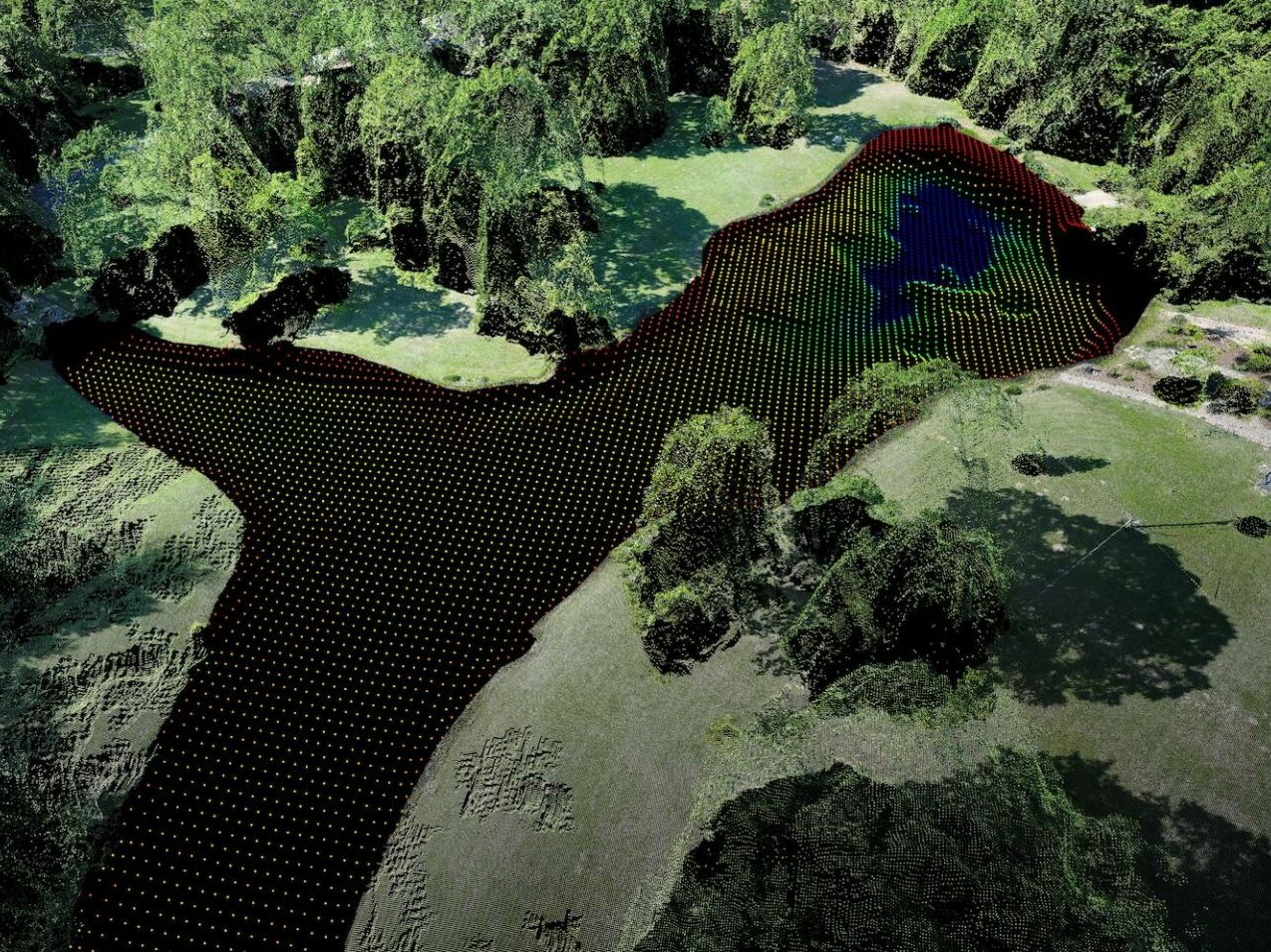
Bathymetric Surveys
DAS Geospatial offers the latest aerial bathymetric survey techniques to acquire data quickly and efficiently in non-navigable waters where vessel-mounted multibeam surveys are not possible, including rivers, streams, and flooded areas or shallow waters with obstructions. Our state-of-the-art bathymetric survey is ideally suited for tracking changes to coast and river depths (e.g., sandbars) and disaster recovery, including damage to coastal infrastructure, among other applications.
Terrestrial LiDAR
Terrestrial LiDAR (also known as Terrestrial laser scanning or topographic LiDAR) acquires 3D coordinates of multiple points for a ground-based object by emitting laser pulses and measuring the distance from the target to the measurement device, providing DAS Geospatial clients design-level 3D and digital terrain models. We combine the latest LiDAR sensor technology with an unmatched background in data acquisition, processing, and analysis, enabling DAS Geospatial to integrate mobile, terrestrial, and historical data for a complete, 4D view of projects over time.