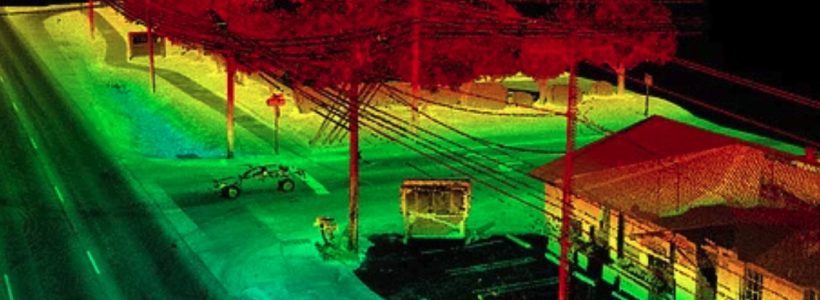
Bringing Point Clouds to Life with Battle Tested Data Processing

These days, drones and UAV imagery are commonplace. Just about anyone with off-the-shelf LIDAR software can create a point cloud. That’s the easy part. Taking that point cloud, the extra mile to a design level map is an art and a science, requiring deep expertise and specialized photogrammetric software.

Does your sUAS provide design level accuracy?

DAS sets the bar in delivering engineer design level mapping. By incorporating sUAS technology into our geospatial platform, DAS is able to optimize the efficiency of sUAS services, while continuing to maintain our high standard of precision mapping.

black quadcopter in sky

Processing UAV Acquired Data

You cannot expect a “push button” solution, which utilizes only an automated workflow, to deliver design-level accuracy.